Maps
There is a lot to know when it comes to getting around the Appleton-Whittell Research Ranch!
We keep an extensive collection of maps describing the ecological resources found on the AWRR, land ownership details, access and road information, soils, vegetative communities, long-term monitoring site locations, rain gauge locations, fire history, invasive species encroachment, wetland and riparian area locations, and more. We offer these maps as PDFs (below) and as more easily usable GIS files.
Start exploring using the links below and, if you can't find what you're looking for or if you need a map in a different format, don't hesitate to reach out at reseachranch@audubon.org.
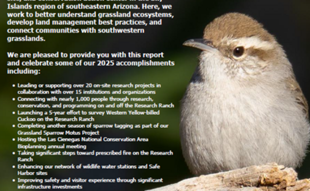
AWRR 2025 Annual Report
Do you ever wonder what keeps us busy on the Research Ranch? Dive in to learn more!
Connect with the Research Ranch
AWRR 2024 Annual Report
Do you ever wonder what keeps us busy on the Research Ranch? Dive in to learn more!

Donate to the AWRR
Donate today and help us continue our work furthering conservation science, engaging people with birds and their habitats, and improving habitat here on the AWRR. Every dollar counts!